Lydford to Peter Tavy Loop
28 miles | 8/10 difficulty | 6–8 hours
About this route


This route is a mix of nice, rideable gravel with some technical descents, a very technical ascent that requires a walk, followed by a rocky, deep rutted track but comes with the reward of some beautiful, remote high moor. There are pubs on the route nicely placed to break up what could be an 8 hour day when you factor in stop time.
This was a 30-mile ride from my house that took me 5 hours in total including time for taking pictures, but I know the route really well so did not have any navigational issues, plus with still being in lockdown there were no pubs or cafes open to divert my progress. Weather
The weather can change quickly on Dartmoor so due to the higher parts of the route, I would always advise on carrying clothing for bad weather.


Map
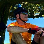
Start point
The route is a loop so you can start at any point but for me, Lydford village is a great start point for this ride as there is the Castle Inn for post-ride food and drink, a small free public car park and even a campsite if looking to do a number of nearby routes over a few days. There are rooms available at the Castle Inn and the Dartmoor Inn (also close to the village). There is also a farm shop on the A386 as you enter the village.
Route overview
From the car park, the route heads back to the A386, through the centre of the village to the entrance of the Granite Way. Following this first part of the Granite Way, you then take a right at the exit point back up to and over the A386, down the side of the Fox and Hounds Hotel and up onto the Rattlebrook Peat Railway; a really nice track. Follow to the end and then navigate left on towards Sourton Tor, then veer off to the left and keep the tor on your right. A long grassy but very bumpy, horse hoof infested descent followed by a nice bit of easy track before another steep descent back onto the Granite Way, right opposite the weirdest pub in the world called The Highwayman Inn. I won’t go into detail here but click the link and take a look. I’ve had a drink there and I really can’t put into words how odd it all is. Harmless but just very, very odd!
Turn left onto the Granite Way, over the stone viaduct and then take the left turn for the Bearslake Inn at the sign, and loop back under the viaduct and back yet again to the A386 (sorry!). This is a bit of a nasty crossing due to traffic speed so do take your time. Head up the road and turn left onto another nice track heading down to the stream crossing and up through the woods and past some cottages before crossing a small road and down towards some open moorland. Stay on this track until the end and take a left back towards Lydford.
Once at the statue in Lydford go straight across and drop down and follow the lane onto a nice track before eventually coming to, yes, the A386. Turn right and stay on the A386 for a mile at most and then turn left towards Willsworthy military camp and back onto the moor for some great gravel and one of my favourite tracks!
Eventually, you’ll drop right down to Hill Bridge followed by a stout climb (on tarmac) up to the Lych Way, also known as Way of the Dead! This only bit of HAB (hike-a-bike) is quite ironic knowing how the parishioners would use this path to carry their dead to be buried in Lydford. Luckily the route only uses a mile or so of this barely visible path and rejoins a rough track that eventually smooths out as you trundle past White Tor before taking a 3-mile descent into Peter Tavy. Great fun on an MTB but far more technical on a gravel bike!
NOTE: This is the hardest and most technical part of the route. You will be ready for a short rest when you get back to the road!
On the way down the track to the road, you will see a small gravestone known as Stephen’s Grave.
There are various accounts of his death in October 1762 but the one thing that is consistent is that he committed suicide as a result of a broken heart.
And as suicides could not be buried in hallow ground, George Stephen’s was buried at a bleak, windswept crossroads on the edge of the moors. It was said that at the very moment he was lowered into his peaty grave, a white sheet that was hanging on a nearby washing line was blown into the sky; up into the air it gently wafted and was never seen again.
As noted above, it was soon reported that his ghost could be seen in the locality of his grave on dark nights. Many local people would not venture out after dark to cross the moor for fear of seeing his tormented spirit.
Above text from Legendary Dartmoor.
The track ends after the grave at a road that takes you down, down, down into Peter Tavy and right past the pub.
If you do stop, BE WARNED.
In summer the local pubs sell a Dartmoor Ale called Three Hares, which they describe as “a delicious golden-brown ale with a rich spicy taste of Devon honey and a hint of apricots”. You will knock back two pints (or more) so easily on a hot summer day with no effort at all, and may then struggle to make it back to Lydford ;-)
After the pub, the nicely graded track takes you down to the river where there is a bench that you can sit at and enjoy the sounds of nature and if needed, dunk your head in the river to try and recover from your Three Hares!
The final few miles back to Lydford follow some nice open moor across Gibbert Hill, known for the thick, winter fog that comes out of nowhere, leaving you going around in circles as you attempt to navigate your way forward. It’s followed by a nice flat track then by a steep road ascent back into Lydford and some more Three Hares at the Castle Inn, assuming they have any left. It sells out quick though as the local pubs only get a few barrels at a time as it’s in limited supply because the amount the brewery makes, is allegedly dependent on how much Dartmoor honey they can harvest!


Route grading
I would consider the route 95% rideable, 20% technical and 5% walking.
I rate this route as 8/10 for difficulty purely down to the technical parts.
- Rideable: tarmac, gravel or hard short grass.
- Technical: easy on an MTB with suspension forks, hard on a gravel bike.
- Walking: steepness, grip or gnarly but rideable on an MTB.
NOTE: I’m an average MTB rider so my version of “gravel” may be slightly more aggressive than other views of gravel. But, I have ridden the entire route on my gravel bike so do not expect any major issues for anyone on a gravel bike.
Weather risk
Dartmoor weather can change very quickly from strong winds to hard rain to very thick fog. The terrain is featureless in many places making it VERY easy to get lost and disorientated.
The parts of this route where weather risks are highest:
- Rattlebrook Peat Railway to Granite Way: Mile 2.5–6/KM 4–10.
- Lych Way to Peter Tavy: Mile 16–21/KM 26–35
Navigation
Overall navigation is fine, the only difficult part is the Lych Way as you head past Bagga Tor on your left, follow a vague track through the grass tussocks before taking a 90 degree right back towards White Tor. As long as you follow the GPS track you will be fine. Trust me!
The GPX file
I’ve made this a Google Drive link available to anyone. This will open a text file, top right there is a download link to allow you to save it to your computer.
RWGPS version
A lot of people use Ride with GPS so this version may make it easier to add it straight to your phone and/or device.
March 2021